Subsurface Utility & Lithological Mapping – District Khushab
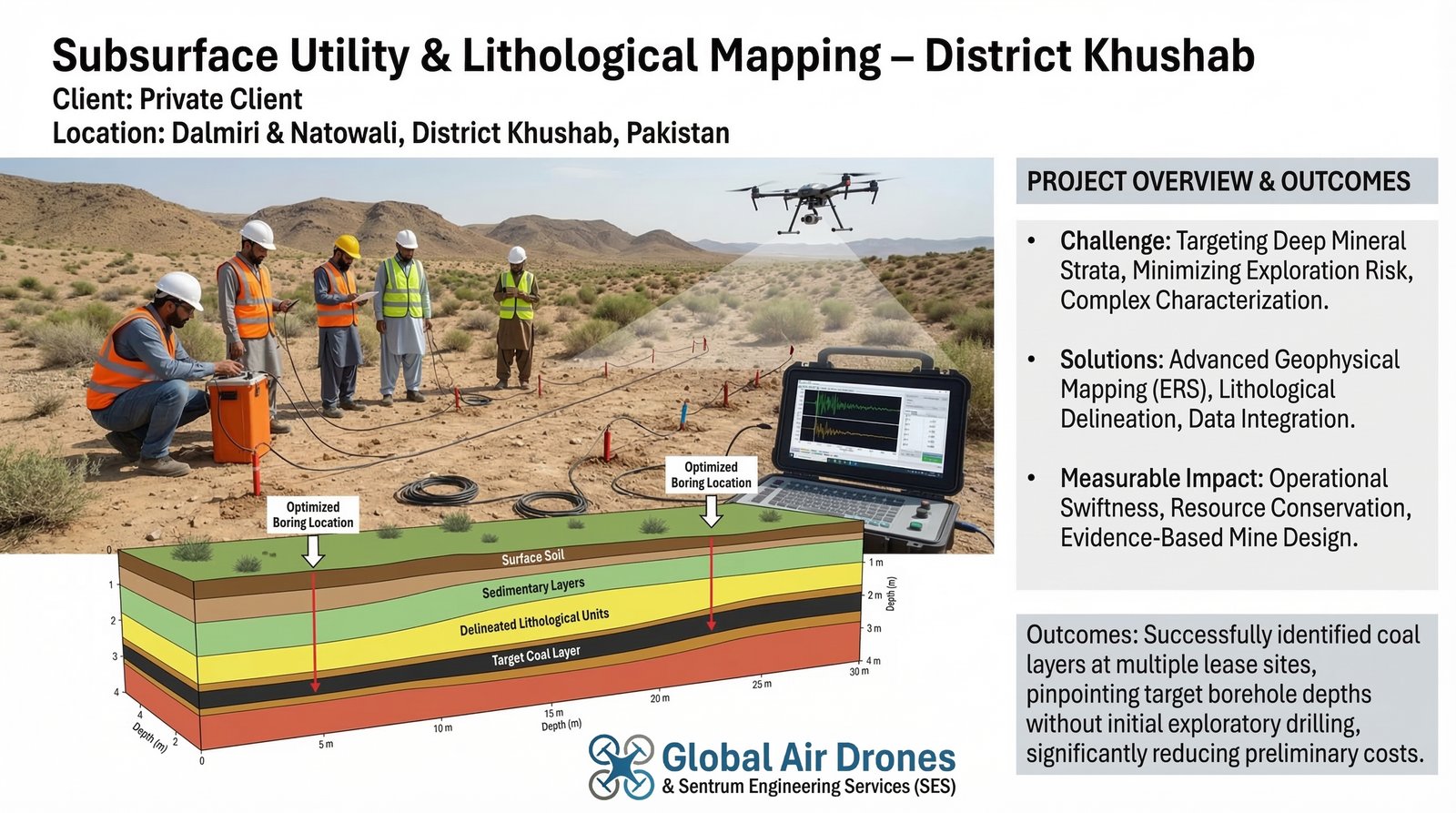
Utilized advanced ERS to delineate subsurface lithological units and successfully identify coal layers at multiple lease sites.
The Challenge
The Subsurface Utility & Lithological Mapping – District Khushab project, executed by Global Air Drones & Sentrum Engineering Services (SES), addressed three critical challenges: targeting deep mineral strata by identifying and delineating specific lithological units, primarily coal layers, at multiple lease sites in Dalmiri and Natowali; minimizing exploration risk by providing an authentic, low-cost subsurface distribution map to guide drilling operations more efficiently; and achieving complex subsurface characterization through accurate mapping of varying lithological units to determine depth and thickness of target mineral seams across a broad area.
Measurable Impact
Operational Swiftness
Advanced ERS mapping enabled rapid identification of target zones, significantly reducing the time required for preliminary exploration and site assessment.
Resource Conservation
Non-invasive survey methods minimized the need for expensive exploratory drilling, conserving both financial resources and environmental impact.
Evidence-Based Mine Design
Detailed subsurface maps provided concrete data for informed mine planning and optimized drilling location selection.
The Solution & Outcome
SES deployed advanced Electrical Resistivity Surveys (ERS) to characterize subsurface soil and rock resistivity across multiple lease sites. By utilizing variations in subsurface electrical conductivity, the team successfully inferred lithological variations and pinpointed the presence of coal layers with high accuracy.
The resistivity data was comprehensively analyzed to create detailed subsurface maps highlighting sedimentary layers and potential mineral formations. This approach allowed for pinpointing target borehole depths on the surface without initial exploratory drilling, significantly reducing preliminary costs and enabling evidence-based decision making for mine development.
Key Technologies Used
- Electrical Resistivity Survey (ERS) for subsurface characterization
- Advanced data analysis for lithological variation detection
- Subsurface mapping and coal layer identification algorithms
- Digital integration of resistivity data for 3D subsurface modeling