Case Studies
Global Air Media has a proven track record of delivering high-impact drone solutions across the globe. Our projects range from security enhancement to educational empowerment.
Our Sun Pvt Ltd 50MWp Solar Plant
A comprehensive drone-guided thermal audit to ensure the structural and operational integrity of a utility-scale solar farm. Captured high-fidelity thermal and RGB data for the entire 50MWp site, identifying specific anomalies from individual cell hotspots to entire string outages.
View Full Case Study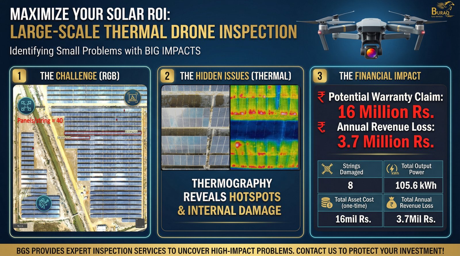
Mahmood Group Thermal Inspection
Comprehensive health assessment of large-scale rooftop solar plants at Mahmood Textile & Mahmood Spinning Mills. Thermal drone inspection of 10K+ panels identified shadow loss, cell damage, and inverter room insulation leaks, enabling proactive maintenance and warranty claims.
View Full Case Study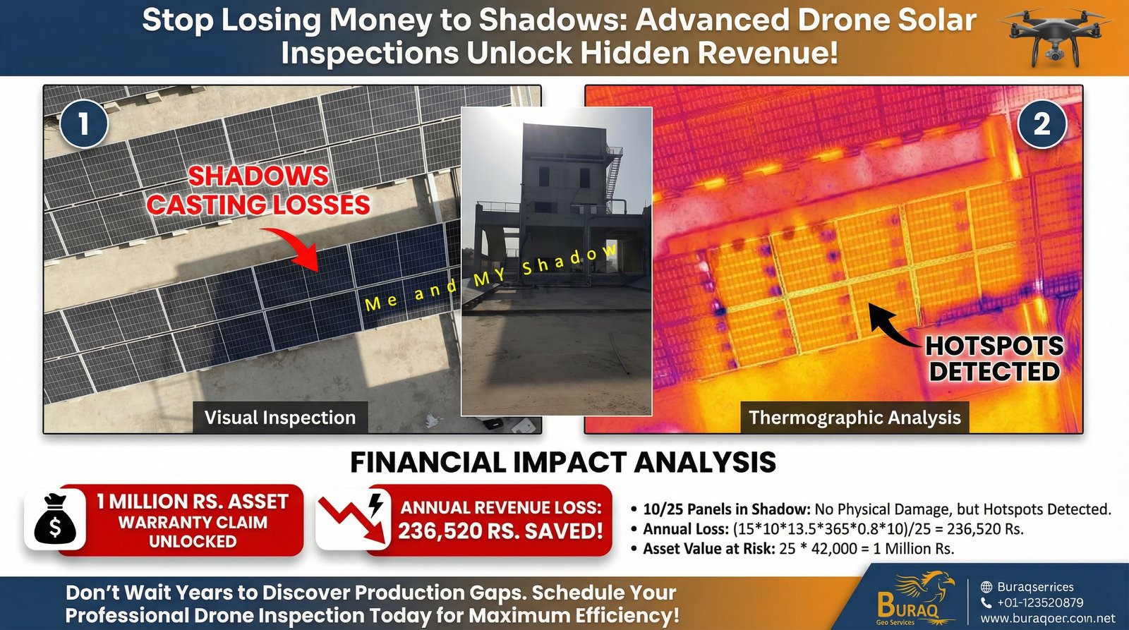
Kazakhstan NSDI Implementation / ADB
A National Spatial Data Infrastructure (NSDI) blueprint aligning governance, standards, and investment to enable interoperable geospatial services at scale. Established standards-aligned baseline and prioritised action roadmap for geodesy, coordinate systems, and scalable platform integration.
View Full Case Study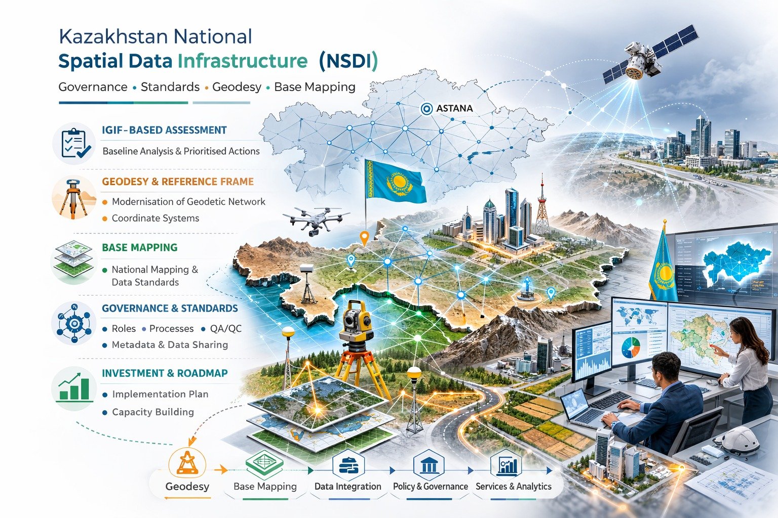
Namibia Spatial Data Quality Handbook
A practical handbook to institutionalise fit-for-purpose quality across national base datasets and production workflows. Integrated ISO-aligned quality management with standard measures, acceptance criteria, and repeatable QA/QC workflows for predictable, auditable data quality.
View Full Case Study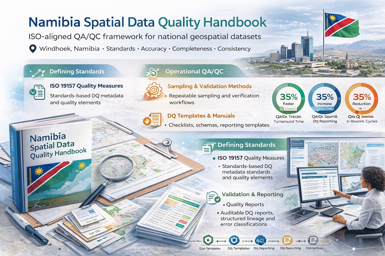
Oman National Addressing System / MoHUP
From policy to operations: standards, governance, and implementation planning for a national addressing system. Integrated standards-based addressing model with operational workflows, QA/QC checkpoints, and implementation guidance to support service delivery and emergency response.
View Full Case Study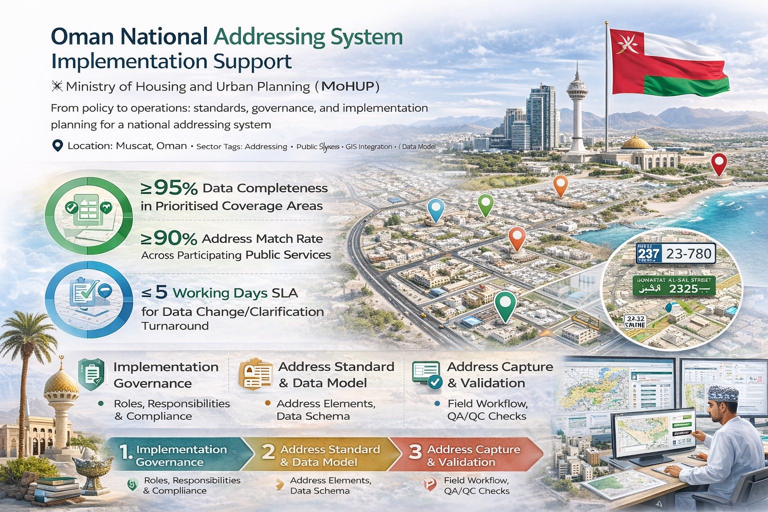
Ground Water Sustainability Study – DHA Bahawalpur
Comprehensive subsurface investigations to detect fresh water aquifers and assess long-term water availability for DHA Bahawalpur development. Integrated Electrical Resistivity Surveys with hydrogeological data to create detailed subsurface maps for informed well location decisions.
View Full Case Study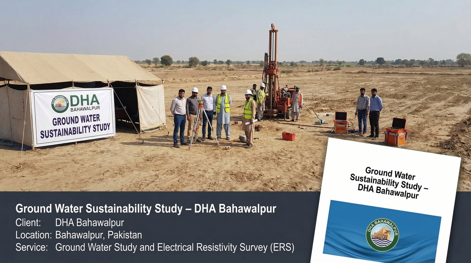
Digital Geological Mapping & Resource Estimation – Gilgit Lead Mine
Detailed geological mapping of a 2 sq. km area, including digitization of geological maps and cross-sections for mineral reserve estimation. Advanced mapping and mineral reserve estimation for mining operations planning.
View Full Case Study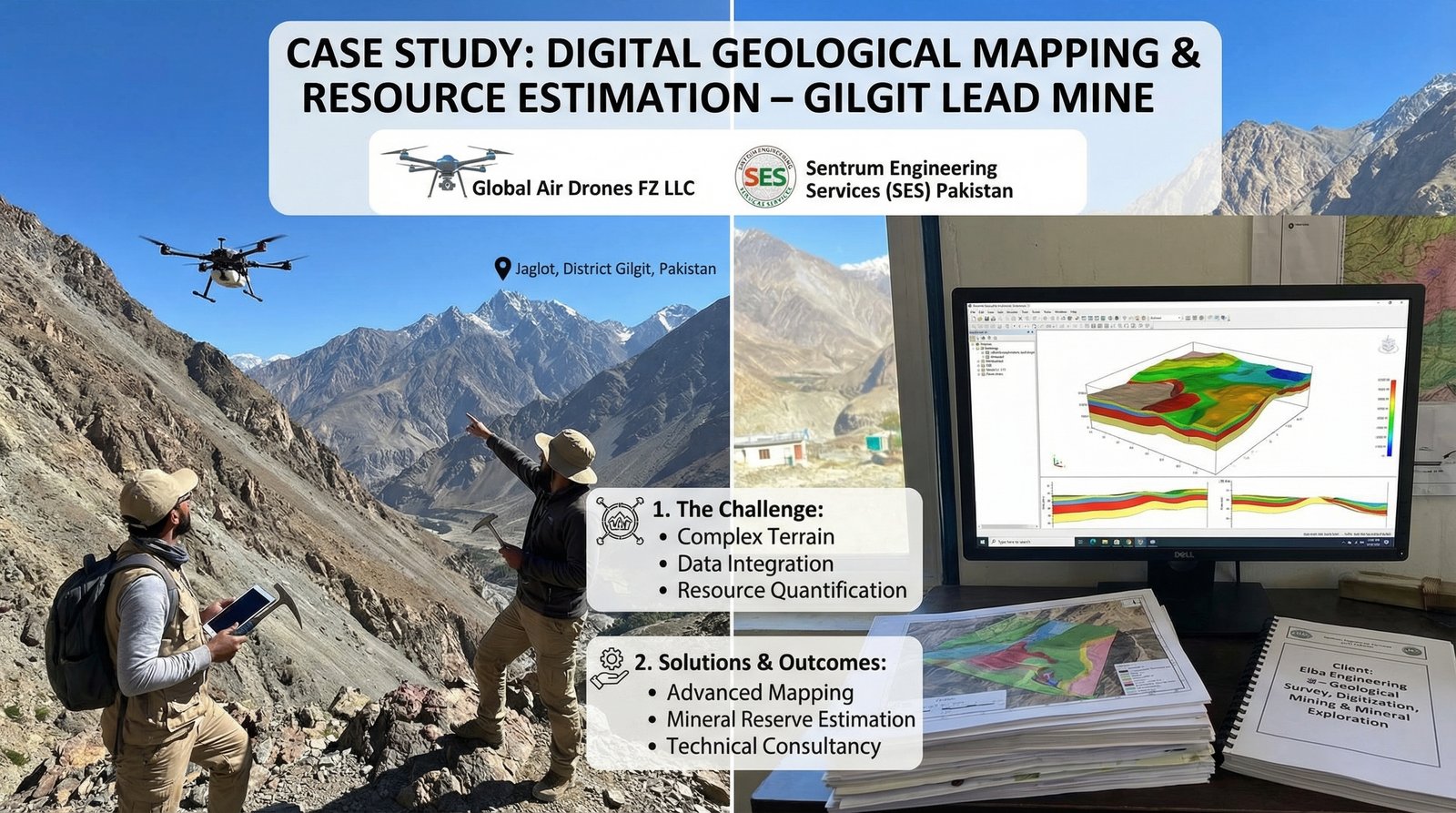
Subsurface Utility & Lithological Mapping – District Khushab
Utilized advanced ERS to delineate subsurface lithological units and successfully identify coal layers at multiple lease sites. Advanced geophysical mapping for optimized drilling operations.
View Full Case Study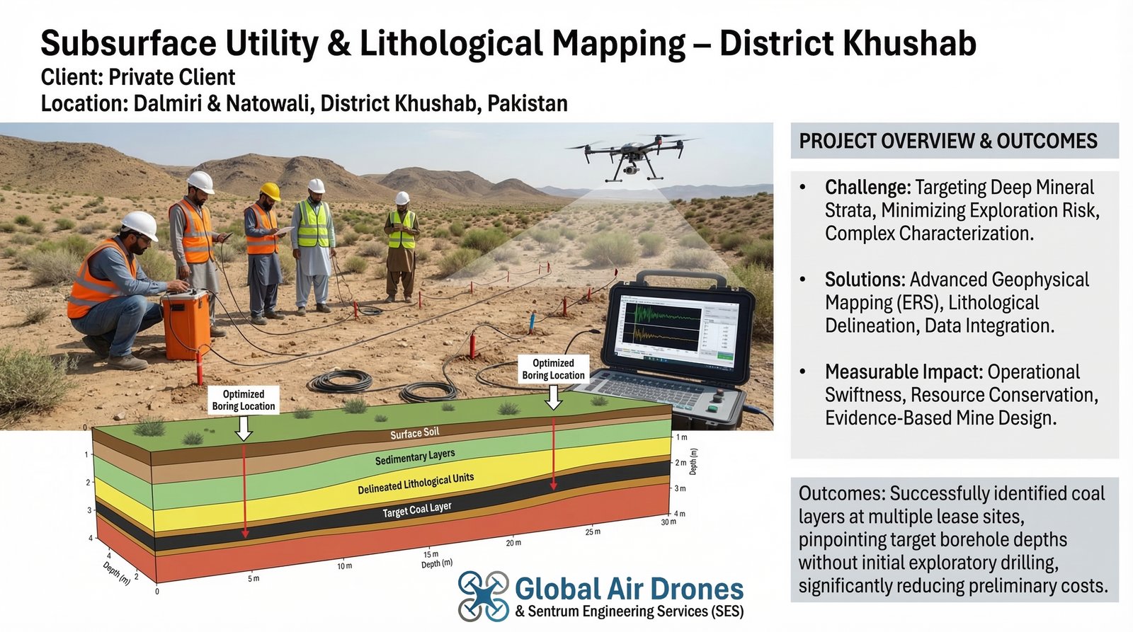
Ground Water Monitoring & Piezometer Network – Punjab Irrigation Dept.
Installed a network of 50 piezometers for continuous monitoring of groundwater levels, providing critical data for regional water management. Advanced telemetry-based monitoring system for water resource management.
View Full Case Study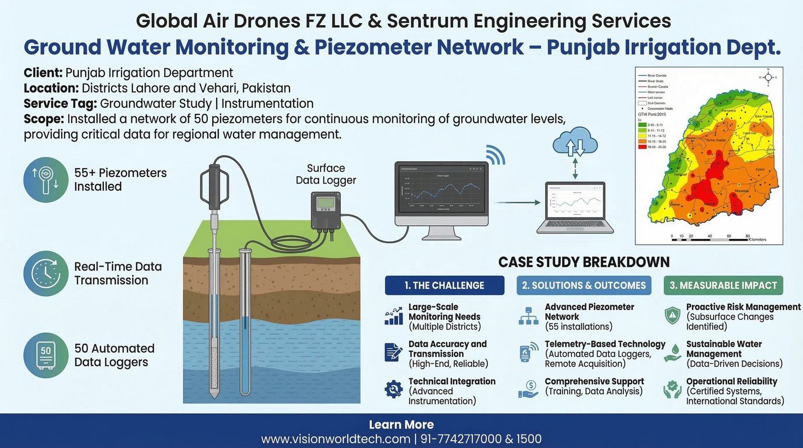
Geotechnical & Seismic Investigation – Royal Palm City
Conducted site-specific soil investigations and electrical resistivity surveys to support infrastructure development and grid station planning. Geotechnical and seismic assessment for critical infrastructure stability.
View Full Case Study
Non-Destructive Structural Health Monitoring – Muridke Foundation Site
Executed Ultrasonic Pulse Velocity (UPV) testing and ferroscanning of shallow foundations for multiple structural columns to verify structural integrity without compromising the build.
View Full Case Study
Emergency Response: When Every Second Matters
Emergency flood response operations providing live aerial surveillance and thermal imaging to locate stranded survivors and guide rescue teams during critical flood disasters.
View Full Case Study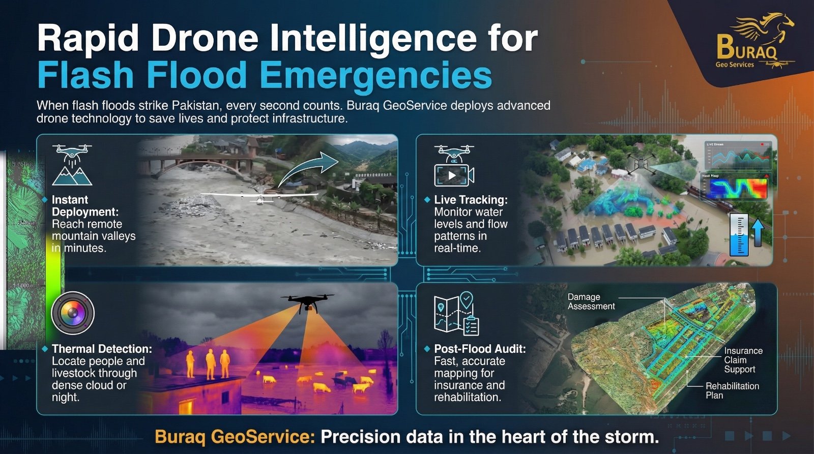
From Degraded Land to Climate Assets
Large-scale VCS ARR project transforming floodplains into resilient, revenue-generating landscapes through afforestation, reforestation, and revegetation using drone photogrammetry and AI analytics.
View Full Case Study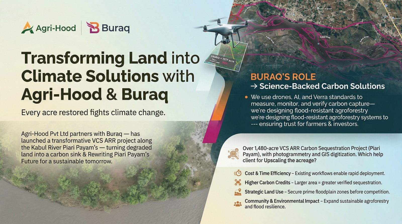
Smart Building Surveys – Tower 12, Islamabad
Rapid deployment for high-story commercial assets using 3D modeling and aerial surveying to extract actionable height, depth, and volumetric data instantly.
View Full Case Study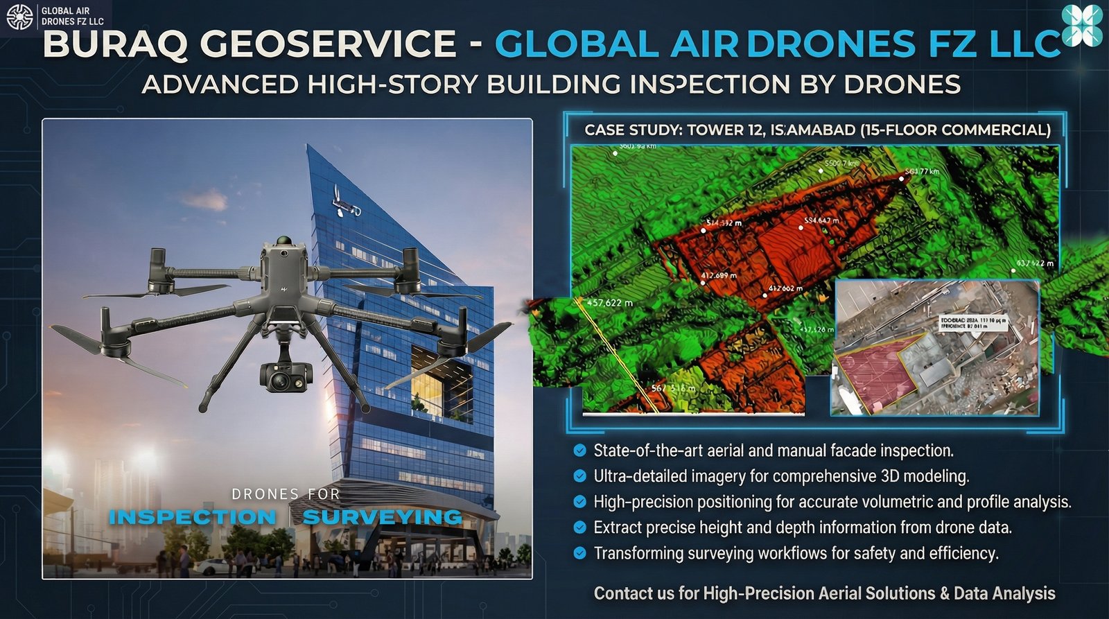
Redefining Hydrological Insights
Advanced UAV technology delivering high-density LiDAR mapping, 3D bathymetric modeling, and precision digital twins for water management and floodplain analysis.
View Full Case Study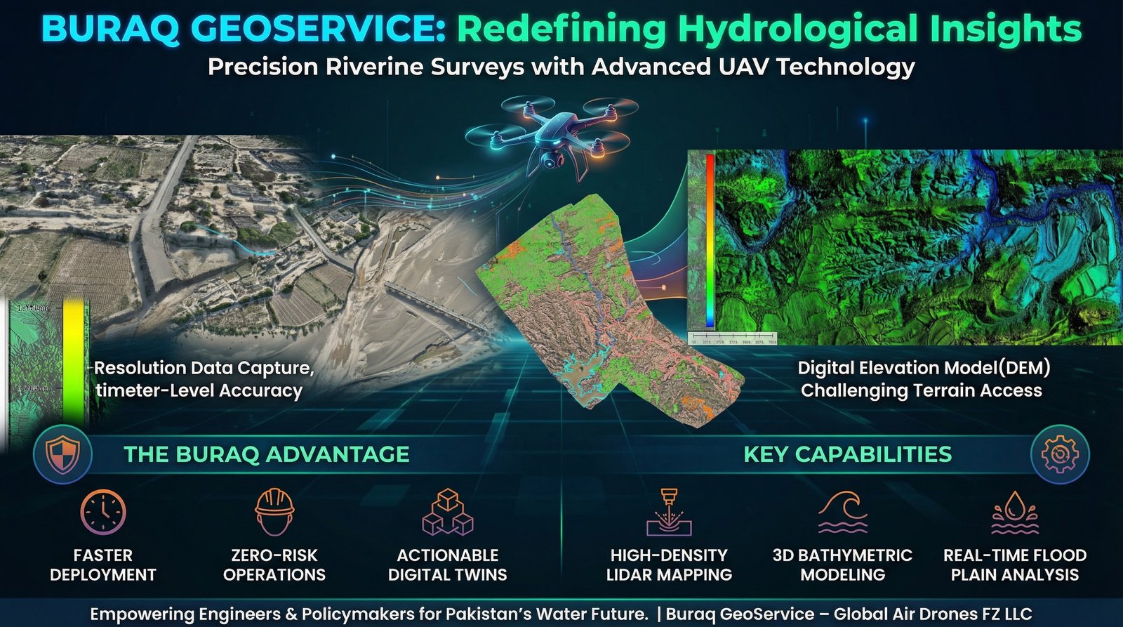
Advanced Solar Power Plant Inspection Services – Pakistan
Advanced drone-guided thermal inspections and AI-based performance analysis for ~100 MW of operational solar PV assets in Pakistan's premier renewable energy hub.
View Full Case Study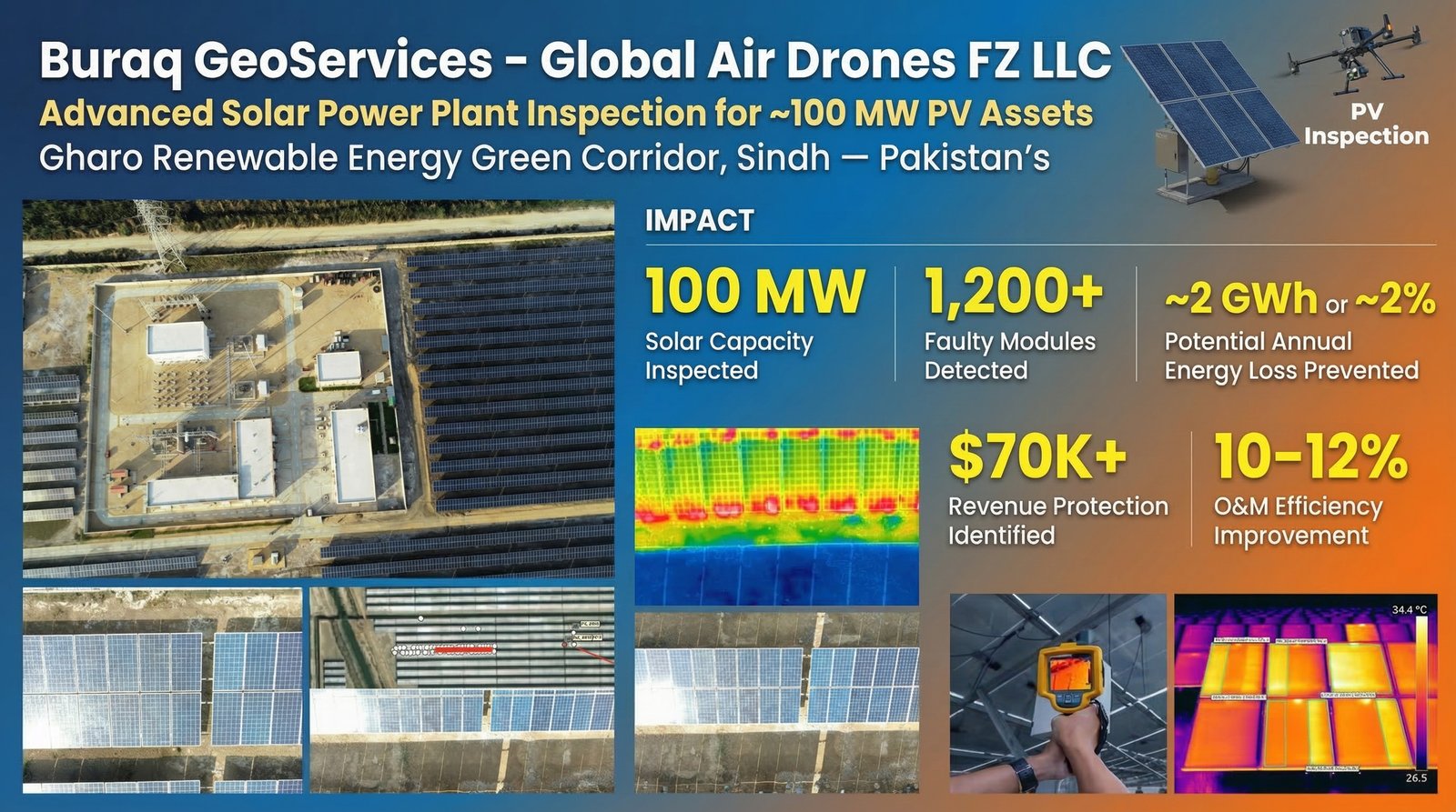
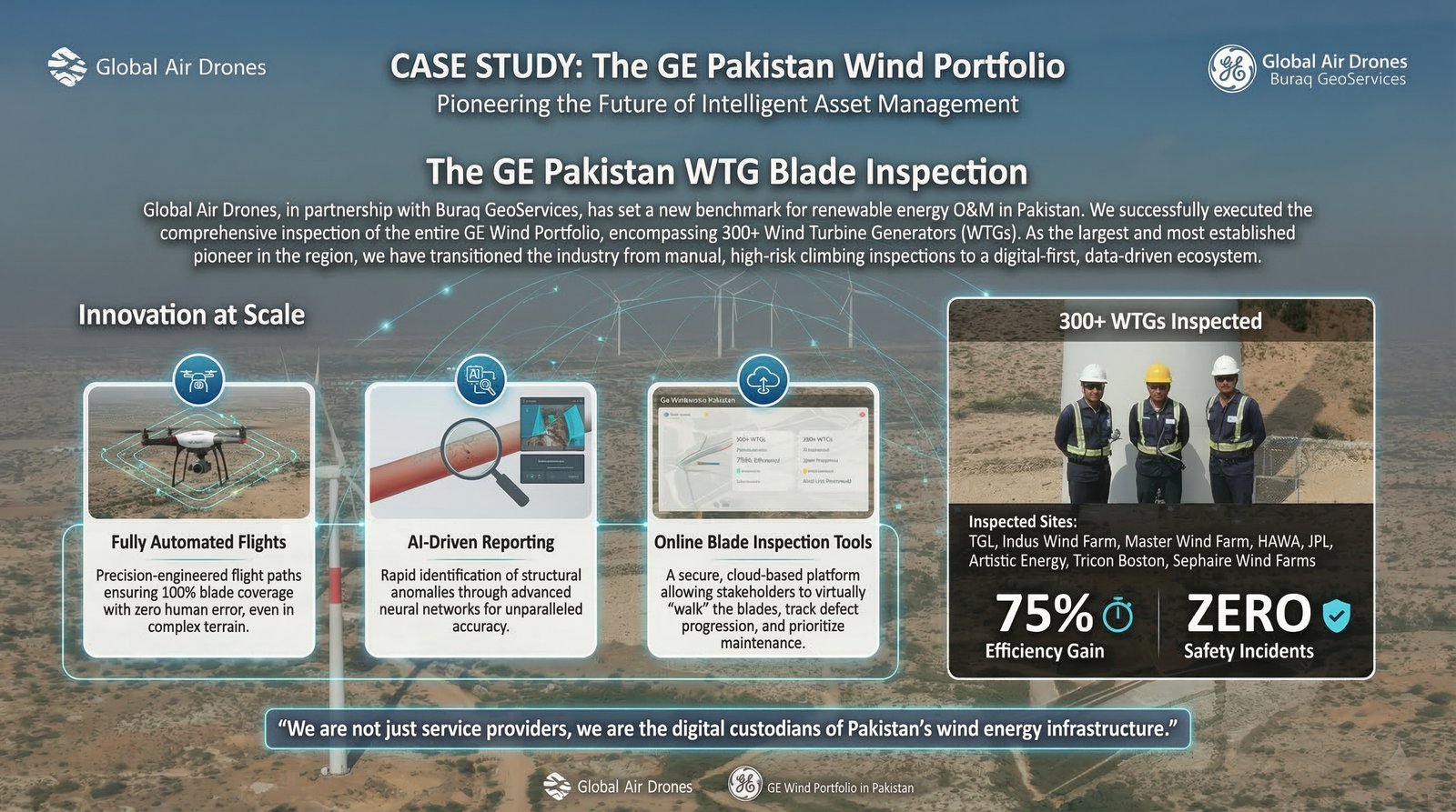
The GE Pakistan WTG Blade Inspection
Comprehensive inspection of GE's entire 300+ Wind Turbine Generators using fully automated flights and AI-driven reporting, setting new benchmark for renewable energy O&M in Pakistan.
View Full Case Study